Many of the programs managed under DFW’s Environmental Affairs Department (EAD) are either driven by regulatory obligations or conservation priorities, but regardless of the driver, the overall objectives are still in line with the Clean Water Act (CWA) to return our nation’s waters to standards that are fishable and swimmable. DFW is committed to operating the airport in a manner that encourages environmental stewardship, social responsibility, and demonstrates performance by exceeding regulatory compliance standards through sustainability, resiliency, and innovation.
At over 17,000 acres, DFW is larger than the city of Manhattan. The Airport manages over 258 miles of storm sewer pipes, over 150 stormwater outfalls, and 26 miles of creeks and channels, discharging into eight distinct watersheds and, eventually, the Trinity River. The two primary programs used to monitor and protect the Airport’s various creeks and tributaries from point and non-point source pollutants are DFW’s Watershed Program and Stormwater Management Program. Both programs reinforce that DFW institute a more holistic and systematic culture dedicated to preserving one of our nation’s most valuable resources – water.
DFW's Watershed
Watershed management is defined as conserving, regulating, and managing the process of land, water, and other natural resources that are available in a watershed. DFW implements a watershed program to monitor the health of Airport watersheds via routine sampling and analysis of water quality data. A 2017 Bioassessment Study conducted in partnership with the University of North Texas revealed that Bear Creek, the Airport’s largest watershed, provided an exceptional rating for aquatic life use, and that Trigg Lake was in good ecological health.
The Airport conducts monthly watershed sampling at six distinct creeks and/or tributaries that traverse airport property, and is also an active participant in the Trinity River Authority (TRA) Clean Rivers Program to support the Texas Commission on Environmental Quality (TCEQ) ongoing assessment of major surface waters within the state of Texas.
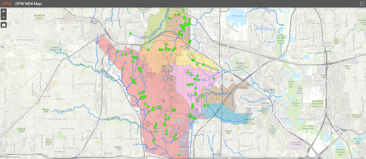
The Airport utilizes a Geographic Information System (GIS) to manage and display major airport infrastructure and utilities. Existing and newly constructed stormwater outfalls are identified and displayed in this system, along with watersheds, creeks, and unnamed tributaries traversing Airport property. This system is utilized to support DFW Airport’s MS4 Program, especially when attempting to locate stormwater infrastructure and investigate potential illicit discharges. DFW Airport’s MS4 Mapping program can be accessed by clicking on the map icon below.

Public Stormwater Complaints
If you have observed any issues that could or already have impacted stormwater at DFW Airport, please fill out our Stormwater Public Complaint form and our team will investigate the issue. Thank you for assisting DFW Airport in caring for the environment around us.
Contact Environmental Affairs
The DFW Environmental Affairs department welcomes your comments and questions. For DFW Sustainability specific inquiries, please email us at sustainability@gabonmagazine.com.

